| Ref |
20120628_ADP |
rev 20160713_ADP |
| File |
cmp-use-maps |
html |
| ID |
Gebruik internet maps |
howto |
Gebruik van "maps" op internet
-
Google Maps
-
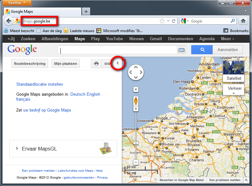
Google Maps opstarten
- Open een browser
- Tik in de adresbalk: maps.google.be
- Routebeschrijving
is nu niet nodig, het linkervenster kan gesloten worden. Klik daarom op
het driehoekje-naar-links midden de pagina.
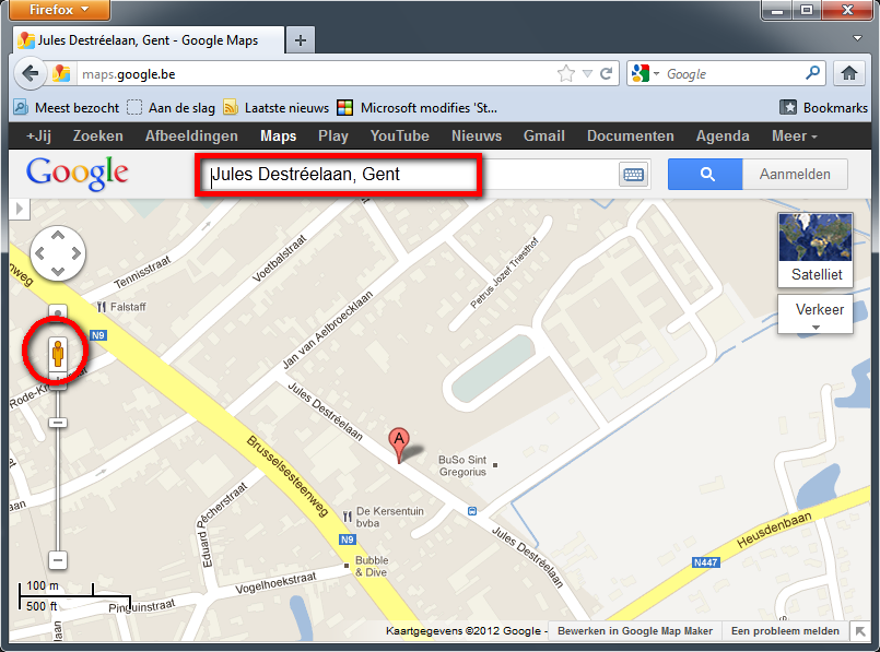
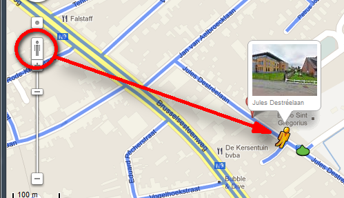
- In de zoekbalk tik je het adres waar je naartoe wil (in
dit voorbeeld: Jules Destréelaan te Gent)
- Je
zoomt voldoende ver in, dat je de straat duidelijk ziet. Let op de
lengtemaat links onderaan, in dit voorbeeld is 100m ongeveer 2cm).
- Je ziet het oranje "streetview-mannetje" aan de
linkerkant boven de zoom-balk.
- Klik
op het oranje "streetview-mannetje", en sleep het naar de straat. De
straten waar je het mannetje kan neerzetten worden blauw gekleurd.
- Hier
zie je dat het scherm in twee is verdeeld: het onderste deel is nog
altijd het stratenplan, het bovenste deel is de "street-view" die
bestaat uit een aaneenschakeling van foto's die gemaakt werden door de
beruchte "google"-auto.
- Links zie je de navigatieknoppen: de richting en de
uitvergoting.
- In het midden zie je de pijltjes waarmee je het
"streetview-mannetje" kan verplaatsen.
- Rechts
zie je in dit voorbeeld bvb een bord, dat je kan uitvergroten om te
lezen wat erop staat. Wordt meestal gebruikt voor bvb wegwijzers.

Lees ook http://www.zdnet.be/tips/170751/tien-verborgen-trucs-in-google-maps/
-
Bing Maps
-
Bing Maps opstarten
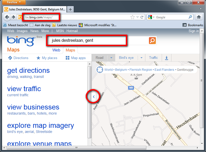
- Open een browser
- Tik in de adresbalk: https://www.bing.com/maps/
- Routebeschrijving
is nu niet nodig, het linkervenster kan gesloten worden. Klik daarom op
het driehoekje-naar-links midden de pagina.
- In de zoekbalk tik je het adres waar je naartoe wil (in
dit voorbeeld: Jules Destréelaan te Gent)
- Je
zoomt voldoende ver in, dat je de straat duidelijk ziet.
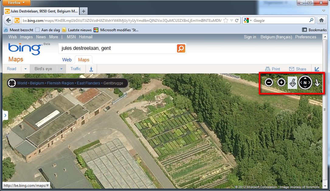
- Wanneer je voldoende ver bent ingezoomd, verschijnt in
de knoppenbalk bovenaan de knop [_Bird's_Eye_].
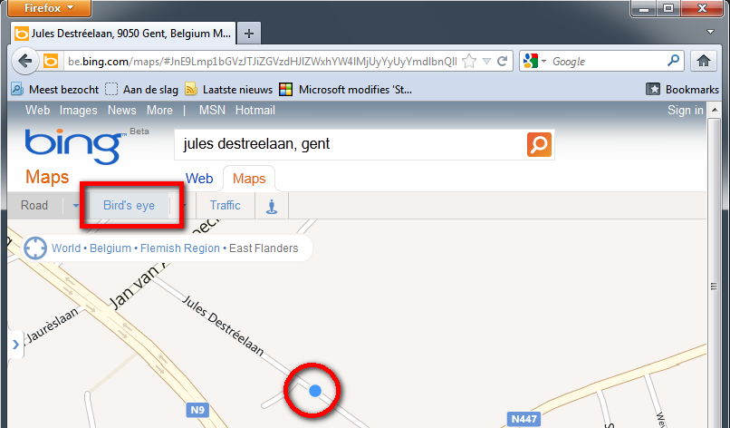
- Klik je op de knop [_Bird's_Eye_],
dan schakelt het scherm over op foto's, gemaakt met een vliegtuig op
lage hoogte. Je hebt telkens vier "zichten" vanuit het vliegtuig (Noord
Oost Zuid West)
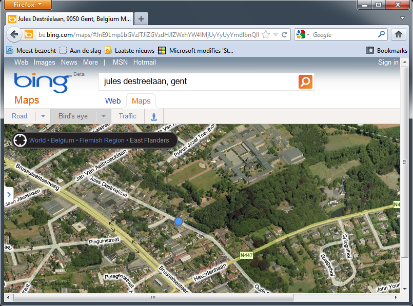
- Je
kan behoorlijk ver inzoomen, en door de vier verschillende hoeken, is
het beeld gedetailleerder dan bvb de sattellietfoto's van Google Earth.